Saturday, July 14, 2012

Lawn Lake Trail - Rocky Mountain National Park

I'm on this trail every year, the Roaring River is one of my favorite greenback cutthroat trout streams in Colorado. I typically stop about two miles in (up) and start fishing. I've always wanted to hike all the way to Lawn Lake, and after seeing a report of monster greenbacks in Big Crystal Lake, I added it to my 2011 trip agenda.

The day finally arrived, I left my younger brother's place in Westminster at 4:30 AM, and went through the park gates before the rangers arrived. By 6:30 AM I was leaving the trailhead at 8,500 feet.

The first mile of this trail (in my opinion) is the most difficult but don't let that discourage you because once you make it to the Horseshoe Falls overlook the trail levels out and stays that way for the next couple of miles. At about four miles the trail hits another section of switchbacks. Just after this the Roaring River changes directions from north/south to east/west and you get your first view of the Lawn Lake bowl and Mummy Mountain.


The trail remains mostly flat while you make the final push toward Lawn Lake, with one more small set of switchbacks. At six miles, and 11,000 feet, I got my first view of Lawn Lake - it's been a long time in the making!


Lawn Lake was not my final destination, so I pushed on up the trail. Colorado had received a very heavy snowfall in 2011 and the trail above Lawn Lake had large drifts remaining.


With the increasing altitude and increased slope, the trail above Lawn Lake gets increasingly more difficult. As you near 12,000 feet you have the option to go to the saddle between the twin 13,000 feet peaks of Fairchild Mountain and Hagues Peak or (my destination) Crystal Lakes.


At this junction, I get my first taste of downhill, with a short downhill to 11,500 feet and Little Crystal Lake.


Little Crystal Lake was not my final destination, but it is a very short distance between Little Crystal and Big Crystal. At just over eight miles and 3,000 feet in elevation gain, I was standing on the edge of Big Crystal Lake and the shadows of Fairchild Mountain.


I sat and watched the massive greenback cutthroat do their mating dance for what seemed like an hour. I was surprised to have another angler show up as I was having a quick lunch before. He had set up camp at the Lawn Lake site. I don't know what I would prefer, the sixteen mile day hike or lugging a pack six miles to Lawn Lake?? After a quick bite to eat, I took the time to look around from the Crystal Lakes perch.

The view from Big Crystal was amazing, not that you should expect anything else when you are above treeline in Rocky Mountain National Park. This is a shot of Lawn Lake, 500 feet below and two miles via the trail.


With the heavy snowpack and late runoff, the wildflowers were in amazing display.


You never know what kind of "critters" you will run into on the high trails. These guys seemed to have no fear of me.


I finally passed a few fellow hikers on the way back to the trailhead, but for the most part I had the trail entirely to myself. I made it back to the trailhead about 2:30 PM, with over sixteen miles and over 3,000 feet of elevation gain on my feet.

My next plan was a hike into the west side of the Indian Peaks Wilderness so I took the Fall River Road to the Trail Ridge Visitor's Center. The late runoff made for some beautiful cascades along Fall River Road.


It's been a while since my last entry and even longer since my last hike....I need to change that!

Chris

Sunday, April 1, 2012

Great Smoky Mountain National Park - Boogerman Trail

What 10-year-old doesn't want to hike a trail called Boogerman?

We tried to hike this trail during our 2010 visit but road closures prevented us from making it to the trailhead. During our 2011 trip we finally made it to the Cataloochee Valley and the Boogerman Trail.

This 8+ mile loop begins with a bridge over the Cataloochee.


After following Caldwell Fork for almost a mile, the Boogerman Trail takes off, up and over the mountain.

From Caldwell Fork, the trail climbs steeply for the next mile. As we climbed away from the main trail, we saw a few very large hemlocks.


Ross' conditioning wasn't nearly what it was the previous year and he struggled through some of the steeper trail sections.


Boogerman climbs then winds along the ridges for about three miles before finally making a descent back to Caldwell Fork. What we found before we started the descent was simply amazing! I don't know if it was an old home site, but whatever it was, it had to have taken somebody a lifetime to complete.

That stone wall was about 3feet high and had to be 100 yards long! The amazing part of it was that it was over 3,000 feet up the mountain and over four miles from the Cataloochee Valley.

Next to the wall was a make-shift shelter in the form of a tree.


Once back to Caldwell Fork it was another 3+ miles back to the trailhead. The trail crosses Caldwell Fork in five or six locations, so we stopped a couple of different times to (successfully) prospect for brookies.

Once back at the trailhead, it was time to drive through the Cataloochee Valley in search for the GSMNP elk herd.


I always carry a DSLR and a handheld video/still camera. During this hike I let Ross carry the handheld. It's interesting to see what catches his eye while we are hiking. The following photos were all taken by Ross.


Finally, before we left the Cataloochee Valley, Ross decided he would take a polar bear plunge into the Cataloochee. : )


It's less than a week before we make our annual journey to the Smokies and I can't wait to see what kind of adventures this year brings.

Chris

Saturday, March 31, 2012

Great Smoky Mountain National Park - Albright Grove Loop

Every year my son and I go to "The Smokies" for his spring break. This year (Easter weekend) will be the fourth consecutive year, so in preparation I thought I would add some of our hikes from previous years.
This hike was completed during our 2010 trip and we were in search of the elusive virgin stand of timber.

We eventually found the trailhead (hidden behind a Jellystone campground), and it was also difficult to find a parking spot. We geared up and watered up in preparation for the near 3-mile hike to the Albright Grove of virgin timber.

The entire 3-mile hike was uphill, so there were a few stops to rest. Ross always finds the best places to relax.


Another mile or so of climbing and it was time for another rest.


About 2.5 miles in you cross Indian Camp Creek, a beautiful little brookie stream....getting closer.


Shortly after crossing Indian Camp Creek, we start noticing a few larger trees, and Ross decides it's time to take another break.....getting close.


You know when you are in the Albright Grove - even without the trail marker. In my 40+ years on the east side of the Mississippi, I've never seen a virgin stand of timber - they just don't exist.


I've been among the ancient ones, 2000+ year old Colorado bristlecones and 4000+ year old California bristlecones, but these trees were impressive in their own right. They are survivors, somehow they survived the late 19th and early 20th century logging boom.
We decided to have a light lunch among the east coast giants. While we were having lunch, I noticed the sound of running water over the mountain behind us. After we finished eating, we bushwhacked through the rhododendron to another nice brookie stream.


After picking up a couple of little Smoky Mountain gems, it was time to head out - at least it was all downhill on the way out. Being downhill the entire way we had time to make a few stops, the first being Indian Camp Creek.


As we neared the bottom, we stopped along a small stream that I had noticed on the way up. What caught my eye on the way up was not the water but the structure alongside it.


I'm not sure what the puprose of the stone wall was, but I'm sure it took somebody quite a while to build. Could it be part of the (now rebuilt) homestead along the trail near the trailhead? Could a be from a family that was forced out of the park when the National Park was created?


Prior to this trip Ross had been running every day during basketball practice, so he was in decent shape, but he was still relieved when we made it back to the trailhead. Over 7 miles and half of it uphill - this is the sign of relief.


I'm looking forward to our 2012 adventure and reliving some of our other hikes in GSMNP.

Chris

Saturday, December 24, 2011

Gila Wilderness, New Mexico - 74 Mountain Trail

I completed this nearly 16-mile day hike in July, 2010. The destination on this hike was Mogollon Creek and the once, nearly extinct, Gila trout. This was also my first adventure with my new SPOT II satellite tracking device.

Gila Trout


Share your Adventures with SpotAdventures

My partner and I arrived at the trailhead at 11:30 PM after almost 29 hours on the road. We awoke early the next morning to see what the area looked like in the daylight. Our destination would be well beyond the far ridge to the right of the trailhead marker.


The first couple of miles of the hike was relatively flat, but then we had a short climb up to the first ridge. The trail may have been flat but the cobble-filled trail made for a knee knocking hike.

When we made it to the top of the first ridge, the views of the New Mexico backcountry were amazing.


From this point, the trail wound for 3-4 miles along the multiple ridge lines. The hiking was easy, but you can see in the next photo the cobble that littered the trail - making the hike more difficult than it should have been.


The trail stays high on the ridge line as it weaves along the contour lines of the topography. The views were unlike anything I had witnessed before - this was my first trip to New Mexico and the United States southwest.


When we finally reached the final ridge we could see our destination - and it appeared to be straight down! The canyon directly across from us was the North Fork of Mogollon Creek, downstream of the section of main Mogollon we were searching for.


From this point it was just over a mile of steep descent to Mogollon Creek.

As you can tell by the photo of the North Fork of Mogollon Creek, the crystal clear main branch cuts through a steep canyon as well.


We fished for a few hours in this beautiful, but extremely rugged canyon, before making the decision to turn for the nearly 8-mile hike out.

I always carry a water filter and a 100 ounce hydration bladder. I made sure the bladder was full for the hike out in the July mid-day New Mexico heat.

The steep downhill last mile of the hike in would be brutal on the way out. The canyon had experienced a burn at some point so there was no canopy to protect us from the sun and heat. A slow steady pace put us back up on the ridge line with no issues.

From here it was just a matter of slowly winding along the ridges - taking it all in.


This last photo is probably my favorite of the entire hike. It is just before we drop off the ridge into the bottom where the trailhead was located. It shows the extreme vastness of New Mexico.


The final few miles were flat but not without incident. Hiking on rubbery legs, it was more difficult to step over some of the cobble and I stubbed my toes on multiple occasions. I also emptied my 100 ounce hydration bladder about a half-mile from the trailhead.

I finally made it back to the vehicle and quickly downed two bottles of water. Later I would find that this hike would cost me six toe nails - and this was the first day of our two week adventure across NM, AZ, CA, OR, NV, and CO.

Chris

Sunday, December 11, 2011

DeCaLiBron - Colorado 14ers

This past August I added three more 14ers to my personal life list. The 7.25 mile loop would put me on top of three summits - the fourth (Mt. Bross) is currently closed.

The trailhead (12,000 feet) is located a few miles above Alma at Kite Lake, and it was crowded that early Sunday morning.


The first half-mile or so was a gradual climb but as you started through the scree to the saddle between Democrat and Cameron, the incline increased significantly. I love the early morning shadows of the Colorado Rockies - I stopped to look back toward the trailhead and I snapped this shot of the shadows.


It seemed like no time at all before I hit the first saddle and the view of the extreme headwaters of the South Platte was amazing.


After a quick stop at the saddle, it was a sharp left turn up Democrat's east slope. This is where the trail gets much steeper and there were several switchbacks to the false summit. It was a slow go between the saddle and the false summit but once to the top of the false summit the Democrat summit was in view. Even though I was hiking solo, I would not be alone on this trek.


A short distance later, I was standing on the summit of Mt. Democrat (14,148) - my third 14er.


I love the views from these summits. From the summit of Democrat I could see Mt. Elbert, which I summited in 2008 - I could not believe how much snow remained in August.


After a short rest on Democrat, it was back down to the saddle on my way to my next two summits. From the edge of the Democrat summit I could see my next two stops Cameron and Lincoln (in the background).


I always struggle on the downhill, it's hard on my old knees, but it was nice to get a breather before starting the climb to the Cameron summit. The climb up Cameron's ridge was not nearly as difficult as the Democrat climb and as the trail swung from the right side of the ridge to the left, I snapped this shot across the valley.


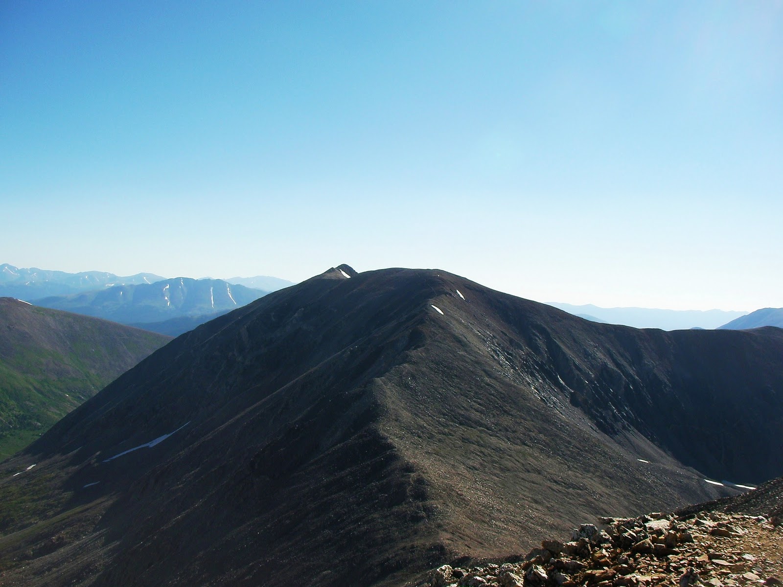
Then, looking back as the trail levels out before the Cameron summit.


From this point it was an easy hike to the large, flat summit of Cameron. I wasn't like a summit at all, more like a football field at 14,000 feet. I stopped only long enough to take a self-portrait on Cameron (14,238), the wind was howling to the point I was nearly blown down, time to find relief from the wind!


My next, and final, summit of the loop is Lincoln - a short distance from the Cameron summit.


After the climb up Democrat, then Cameron, the short trek to Lincoln was relatively easy. I say "relatively easy" because over 13,000 feet nothing is EASY. You can see the well-defined trail from near the Lincoln summit.


I didn't get a summit portrait on the small summit of Lincoln (sharp contrast to the size of Cameron's summit), but I did get a couple of other shots . Mt. Lincoln summit (14,286 feet) and 14er number five for me.


A much better shot to the north of the alpine lake and Quandary Peak.


After another quick summit stop, it was all downhill! The trail below the Cameron summit was very nice allowing me to make very good time on the way down.

After passing below the Cameron summit I stopped the Cameron - Bross saddle to take a look back at where I had been earlier. From this saddle you can see the incline I climbed to get to the Democrat summit.


Then looking back at the large Cameron summit (left) and the small Lincoln summit (right)...


...then, finally, looking down at the Kite Lake trailhead.


If the summit for Mt. Bross was not on private property I could have added another 14er to my list.


I mentioned that downhill is hard on my old knees, well, I've never experienced downhill of this magnitude. Between the steepness of this downhill and the loose scree, this was quite a challenge.


I'm not sure what part of this loop was slower the climb of the final descent, but I made it down without falling.

The entire loop is just over seven miles with 3,700 feet of elevation gain and I made it back to the trailhead in under four hours.

 I enjoy taking time out of my fishing trips to knock these 14ers out...here's to my next summit!

Chris