This is a continuation of my trip into the Nevada desert in search of Lahontan cutthroat...there were no trout harmed in the making of this entry.
From the Lahontan stream I drove to Bishop, California in preparation for my hike into the bristlecone grove - my first time to California.
I rose early the next morning to get some nice shots of the Sierras in alpenglow. I was amazed at how much snow remained up high. This snow is what pointed me to Bishop when I wanted to go to Lone Pine in search of my first true golden.
Due to snow, the road into the bristlecones was closed two from the trailhead, so I parked at the gate and the Sierra overlook.
 You can see why the road was closed, but it probably won't be long before it opens.
 I had the 4.5-mile loop trail all to myself, didn't realize until later that this may not have been a good idea.
 Shortly into the trail, the sign says, "stay right", so I went right. I soon found that all north-facing slopes had a good bit of snow remaining. After about 1/4 mile of intermittent searching for the trail and post holing, the trail disappeared.
 At this point I turned around and decided to take the left fork of the trail. As I made my way around to the east and south facing slopes the trail opened up and became much easier to follow. I soon found myself among the ancient ones.
 These California bristlecones (Pinus longaeva) are a different species than the bristlecones I visited in Colorado (Pinus aristata) and much older. This loop and this grove is said to contain the oldest tree in the world Methuselah, which has an estimated germination date of 2832 BC - and this is why I made this journey.
 I didn't know the exact location, all I had were GPS coordinates and a photo. Unfortunately, my GPS is in dire need of a charging cable, so I was "flying blind".
 I started the hike with three layers (it was in the upper 30s) but as the sun rose higher it turned into a beautiful day.
 I believe Methuselah is somewhere in the vicinity of the next photo, but without my GPS I couldn't pinpoint it exactly.
 As I made it to the 3.5-mile mark of the trail, I knew that I would soon be encountering the section of the tail that remained buried beneath a few feet of snow, so when I intersected the Schulman cabin trail I made a very good decision. I was now out of water (1.5 liters) and solo, so I made the decision to take the shortest route back to the vehicle.
 The cabin trail took me up several switchbacks to a saddle where I could see the road to the trailhead.
 From the saddle, I abandoned the trail (I normally abide by the off-trail restrictions) and headed straight downhill to the road. I stopped one last time to take a shot of this solo tree....
 ...and this unusual remnant.
 One last note from my first adventure in the Sierras: it amazes me to see cactus around 10,000 feet!
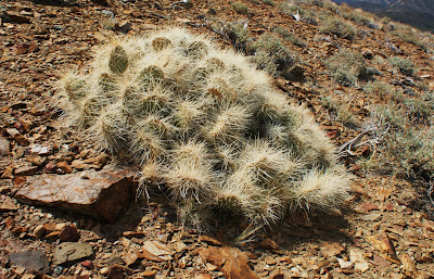 This specimen was somewhere around 8,000 feet on the way back to the main road.
 Finally, this guy that just screams "Do Not Touch", were quite common in the California and Nevada desert floor.

From the Lahontan stream I drove to Bishop, California in preparation for my hike into the bristlecone grove - my first time to California.
I rose early the next morning to get some nice shots of the Sierras in alpenglow. I was amazed at how much snow remained up high. This snow is what pointed me to Bishop when I wanted to go to Lone Pine in search of my first true golden.
Due to snow, the road into the bristlecones was closed two from the trailhead, so I parked at the gate and the Sierra overlook.
 You can see why the road was closed, but it probably won't be long before it opens.
 I had the 4.5-mile loop trail all to myself, didn't realize until later that this may not have been a good idea.
 Shortly into the trail, the sign says, "stay right", so I went right. I soon found that all north-facing slopes had a good bit of snow remaining. After about 1/4 mile of intermittent searching for the trail and post holing, the trail disappeared.
 At this point I turned around and decided to take the left fork of the trail. As I made my way around to the east and south facing slopes the trail opened up and became much easier to follow. I soon found myself among the ancient ones.
 These California bristlecones (Pinus longaeva) are a different species than the bristlecones I visited in Colorado (Pinus aristata) and much older. This loop and this grove is said to contain the oldest tree in the world Methuselah, which has an estimated germination date of 2832 BC - and this is why I made this journey.
 I didn't know the exact location, all I had were GPS coordinates and a photo. Unfortunately, my GPS is in dire need of a charging cable, so I was "flying blind".
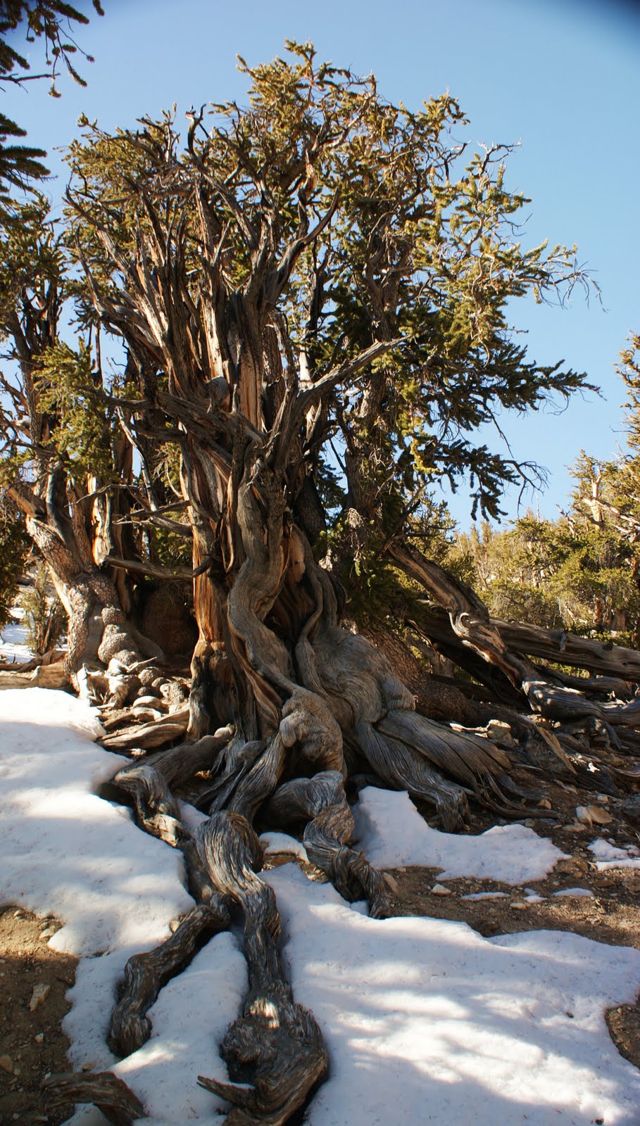 I started the hike with three layers (it was in the upper 30s) but as the sun rose higher it turned into a beautiful day.
 I believe Methuselah is somewhere in the vicinity of the next photo, but without my GPS I couldn't pinpoint it exactly.
 As I made it to the 3.5-mile mark of the trail, I knew that I would soon be encountering the section of the tail that remained buried beneath a few feet of snow, so when I intersected the Schulman cabin trail I made a very good decision. I was now out of water (1.5 liters) and solo, so I made the decision to take the shortest route back to the vehicle.
 The cabin trail took me up several switchbacks to a saddle where I could see the road to the trailhead.
 From the saddle, I abandoned the trail (I normally abide by the off-trail restrictions) and headed straight downhill to the road. I stopped one last time to take a shot of this solo tree....
 ...and this unusual remnant.
 One last note from my first adventure in the Sierras: it amazes me to see cactus around 10,000 feet!
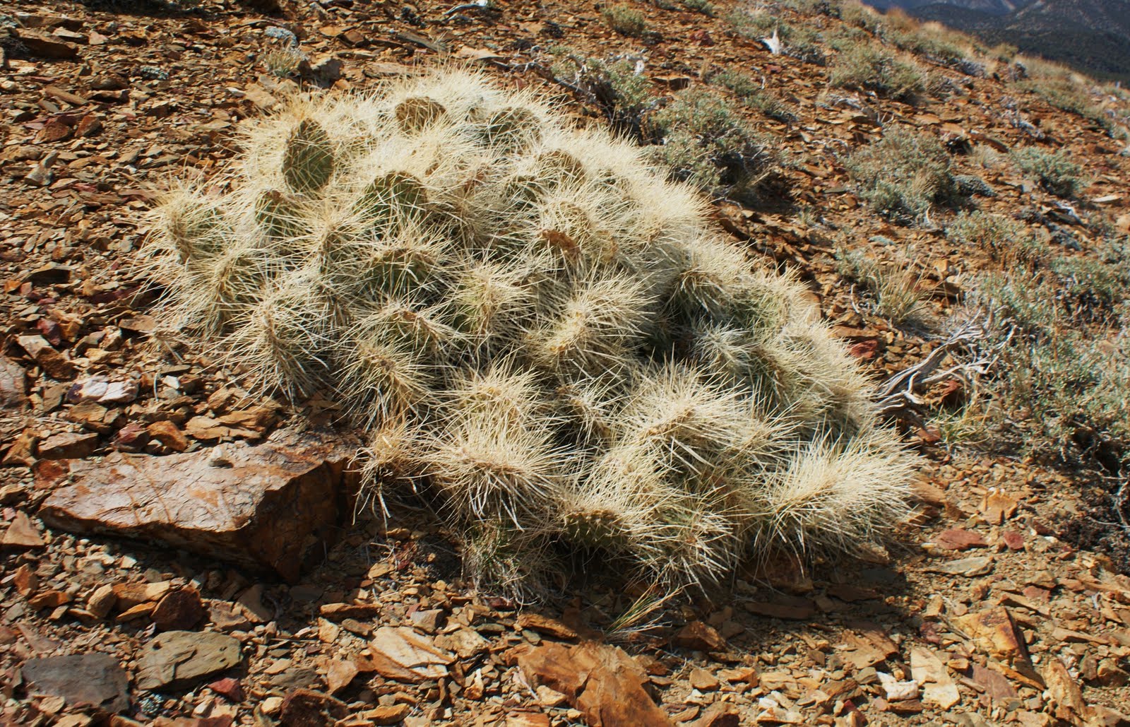 This specimen was somewhere around 8,000 feet on the way back to the main road.
 Finally, this guy that just screams "Do Not Touch", were quite common in the California and Nevada desert floor.
I did not find Methuselah but it was a nice hike (8-10 miles) and it was nice to be back up in altitude. I'll take 50% on a short trip like this!
I plan to revisit the Sierras later this year, but next time I will be packing a fly rod and (hopefully) there will be a few trout involved.
Chris


